
शैलुङ
Sailung
सवारी पहुँच छैन
यस ठाउँबारे
Sailung Dolakha, बागमती प्रदेश, नेपालमा ३,१४६ मिटर उचाइमा पर्छ (अन्य स्रोत)। पछिल्लो मिति सहितको प्रत्यक्ष अवलोकन: सेप्टेम्बर १०, २०२४ (एक वर्षभन्दा पुरानो)।
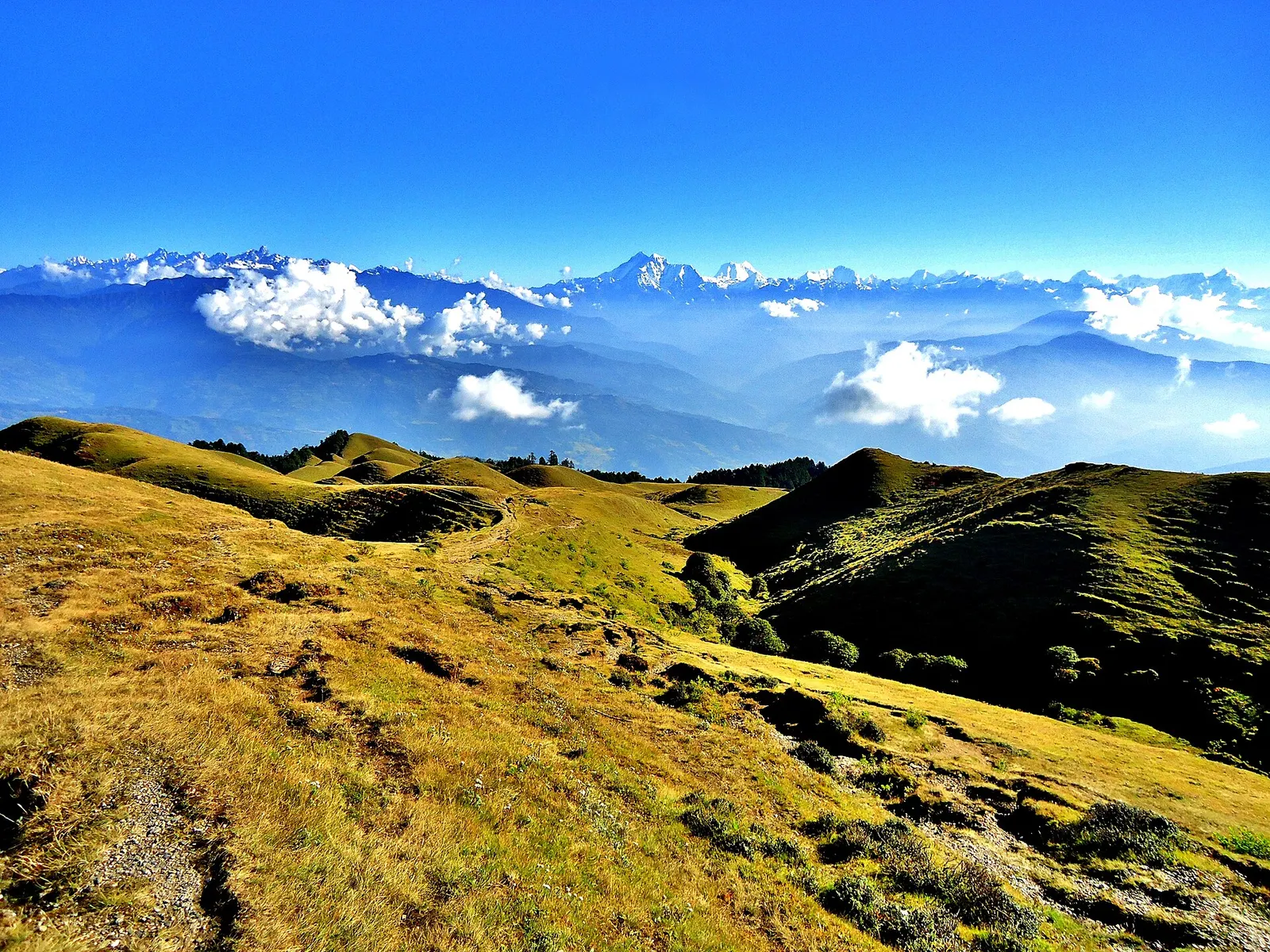
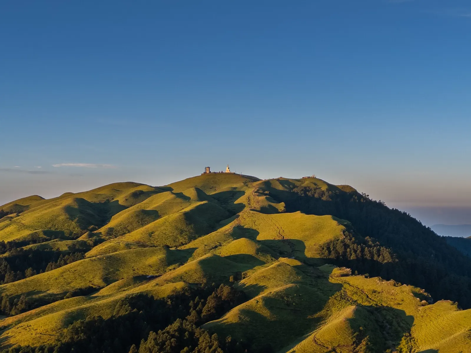
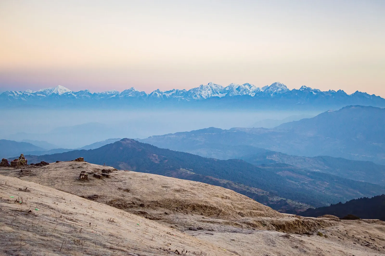
शैलुङ दोलखा र रामेछापको सिमानामा ३,१४६ मिटर उचाइमा रहेको, रूख नभएका स-साना घाँसे थुम्काहरूको डाँडा हो, जसलाई 'सय थुम्का' भनिन्छ; सबैभन्दा अग्लो थुम्कामा भ्युटावर र चैत्य छन्। टुप्पोबाट उत्तरतिर गौरीशंकरसहितका हिमशृङ्खला लहरै देखिन्छन्, र सूर्योदय हेर्न तथा हिउँदमा हिउँ खेल्न मानिसहरू खुला चौरमा टेन्ट टाँगेर बस्छन्। चरिकोट जाने बाटोको मुडेबाट छुट्टिने सडक कालापानीमा टुङ्गिन्छ, जहाँ गाउँपालिकाले प्रतिव्यक्ति ५० रुपैयाँको प्रवेश टिकट काट्छ; त्यहाँबाट ढुङ्गाको सिँढी र पदमार्ग हुँदै करिब एकदेखि डेढ घण्टामा टुप्पोमा पुगिन्छ। अर्को सडक रामेछापतर्फको खोलाखर्कसम्म पुग्छ, र दुवै ठाउँमा केही लज र होमस्टे छन्।
पुग्ने बाटो
सवारी पहुँच छैन · ७५ मिनेट हिँडाइ
बाटो देखाउनुहोस्सवारी पहुँच छैन · ७५ मिनेट हिँडाइ
कसरी पुग्ने
- Kalapani (Sailung Rural Municipality, Dolakha), where the northern road ends
- Four-storey view tower and a Bodhi chaitya (chorten) on the highest hillock; the stone stairway called the 'Mini Great Wall' above Kalapani; Sailungeshwar Mahadev temple and cave; the Bhimsen sword rock.
- Mude-Baghkhor-Dhunge-Kalapani road, which leaves the Lamosanghu-Jiri (Charikot) road at Mude; about 19 km from Mude to Kalapani.
- Kalapani parking area and ticket counter, at the foot of the Mini Great Wall stairway. A second trail starts at Khola Kharka on the Ramechhap side.
- उपलब्ध · Signposted parking area at Kalapani beside the start of the stairway; it fills up on holidays such as Nepali New Year.
- Kalapani on the Dolakha side (buses and private vehicles reach its parking area) or Khola Kharka on the Ramechhap side.
- Blacktop from Kathmandu to Mude. Of the 19 km from Mude to Kalapani about 9 km were blacktopped by November 2025; the rest is a narrow, bumpy dirt road under upgrade. It turns slippery and vehicles can get stuck after snow and in the monsoon.
- A direct bus runs from Kathmandu (Jadibuti / Koteshwor) to Kalapani, leaving about 7 am and taking around 6 hours; it returns from Kalapani about 8-9 am. Otherwise take any Charikot or Jiri bus to Mude and a local bus or jeep on to Kalapani. By motorbike or car it is a one-day drive from Kathmandu.
- From Kalapani climb the stone stairway (the 'Mini Great Wall', about 450 m long) and follow the trail over the grass hillocks to the view tower: 1 to 1.5 hours, steep in places, and hard to follow in fog. Khola Kharka on the Ramechhap side is closer to the top.
- ४.५ किमी (भ्रमणकर्ताले बताएको)
- ७५ मिनेट (भ्रमणकर्ताले बताएको)
- मध्यम
सुविधा र जमिन
- घाँस
- छाया छैन
- खुला
- No shops on the hill. Tea shops and small lodges at Kalapani and Khola Kharka; the last proper bazaar is Mude, 19 km before Kalapani.
- Lodges at Kalapani and hotels and homestays at Khola Kharka serve meals; yak (chauri) milk, churpi and local potatoes are the specialities.
- Kalapani: 2 to 3 lodges and a round guest house, often full in peak season. Khola Kharka: hotels, a community lodge and homestays in about 10 houses. More lodges at Dhunge and Mude.
शुल्क र अनुमति
- रु ५०
- प्रति व्यक्ति
- आवश्यक
- Rs 50 per person entry ticket at Kalapani (Rs 25 for students, children and senior citizens; local residents free), charged by Sailung Rural Municipality from the fiscal year that began in July 2025 and continued from 17 July 2026. No national park or conservation area permit applies.
- The dirt section from Mude is muddy and difficult; cloud and fog often hide the view and the trail.
- Snow falls on the hillocks between Poush and Phagun; the dirt road gets slippery and vehicles and motorbikes can get stuck. Nights are well below freezing.
१५ कुरा अहिलेसम्म कसैले बताएका छैनन्
समुदाय
अवस्था रिपोर्टहरू
फोटोहरू · ४
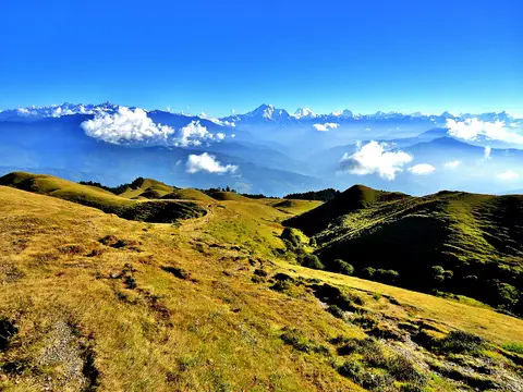
The grassy hills of Sailung with the Himalaya behind. Photo: Ujwal thokar / Wikimedia Commons, CC BY-SA 3.0
हटाइएको प्रयोगकर्ता · अक्टोबर ०९, २०११
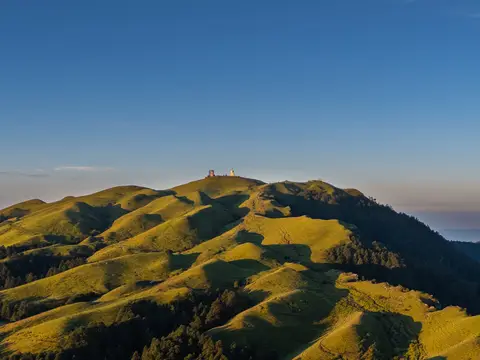
Morning light over the Sailung hills. Photo: Megaurab09 / Wikimedia Commons, CC BY-SA 4.0
हटाइएको प्रयोगकर्ता · सेप्टेम्बर १०, २०२४
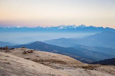
Jugal Himal and Langtang Lirung seen from Sailung Danda. Photo: Subarna1228 / Wikimedia Commons, CC BY-SA 4.0
हटाइएको प्रयोगकर्ता · नोभेम्बर ११, २०१७
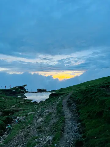
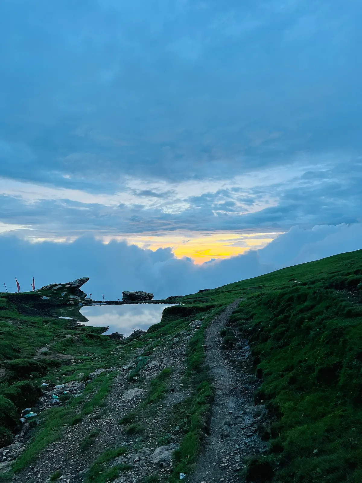
Trail and pond on the Sailung ridge in the monsoon. Photo: Utsab-paude99 / Wikimedia Commons, CC BY 4.0
हटाइएको प्रयोगकर्ता · जुलाई १६, २०२३
सामुदायिक रिपोर्टहरू कुनै निश्चित मितिका व्यक्तिगत अवलोकन हुन्। campinnepal ले तिनको पुष्टि गर्दैन र यी सुरक्षा सल्लाह होइनन्। जानुअघि स्थानीय रूपमा बुझ्नुहोस्।
यो शिविरस्थलबारे केही सेयर गर्ने पहिलो बन्नुहोस्
नजिकै सामान भाडा
सबै विक्रेता हेर्नुहोस्४० किमी भित्र कुनै विक्रेता सूचीबद्ध छैन।