
Sailung
शैलुङ
No vehicle access
About this place
Sailung is in Dolakha, Bagmati Province, Nepal, at 3,146 m elevation (other source). Last dated first-hand observation: 10 Sept 2024 (more than a year ago).
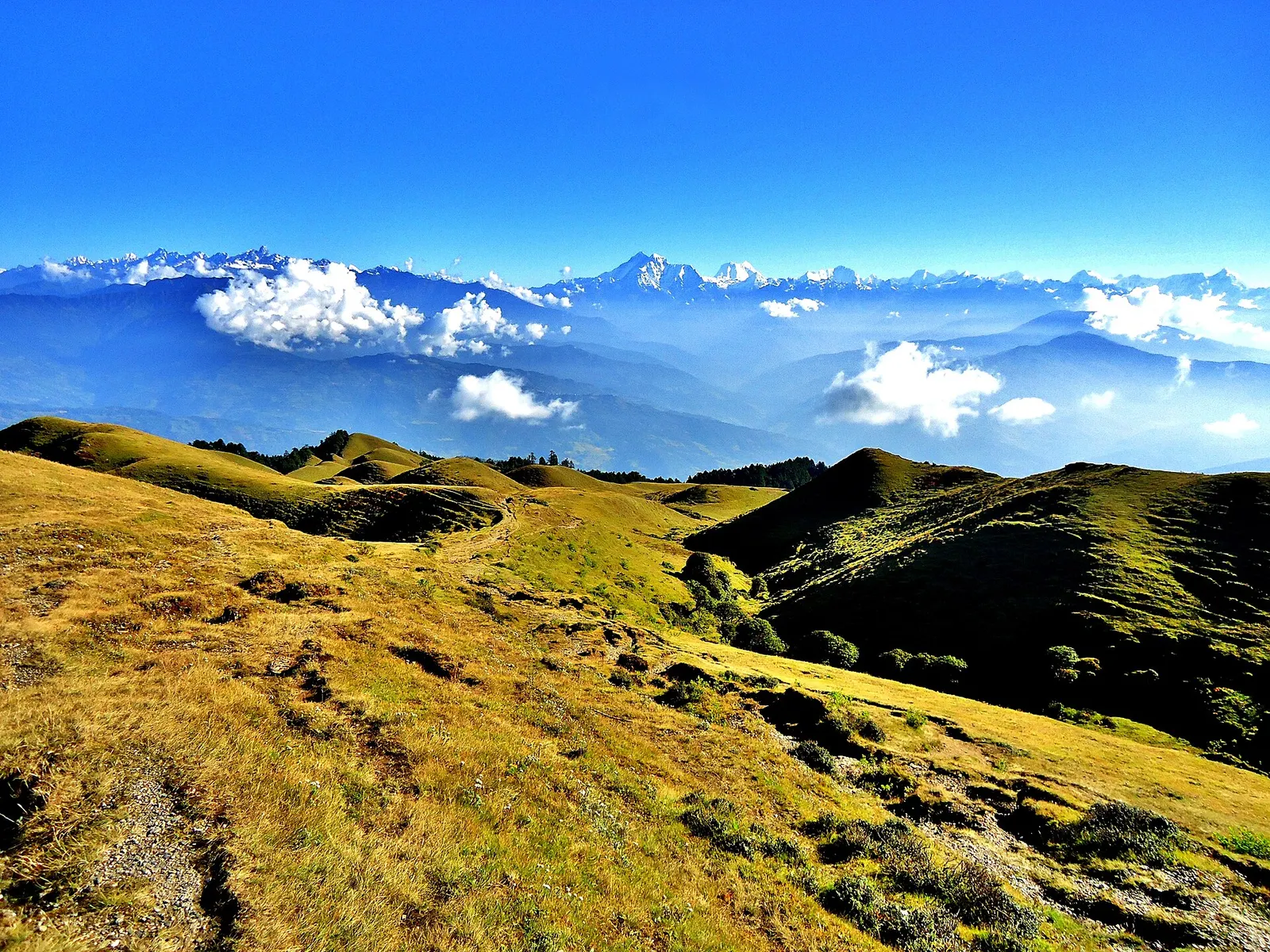
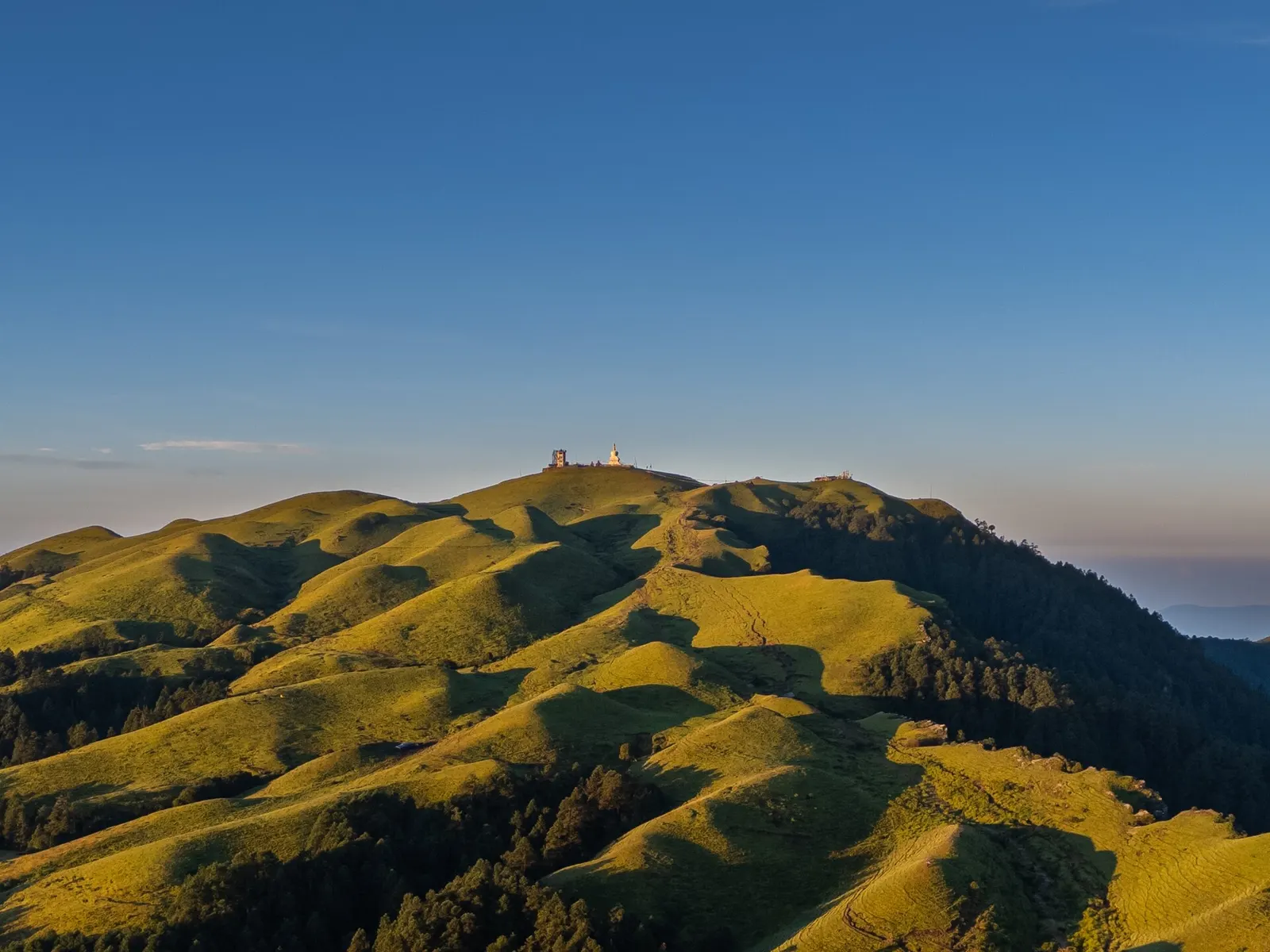
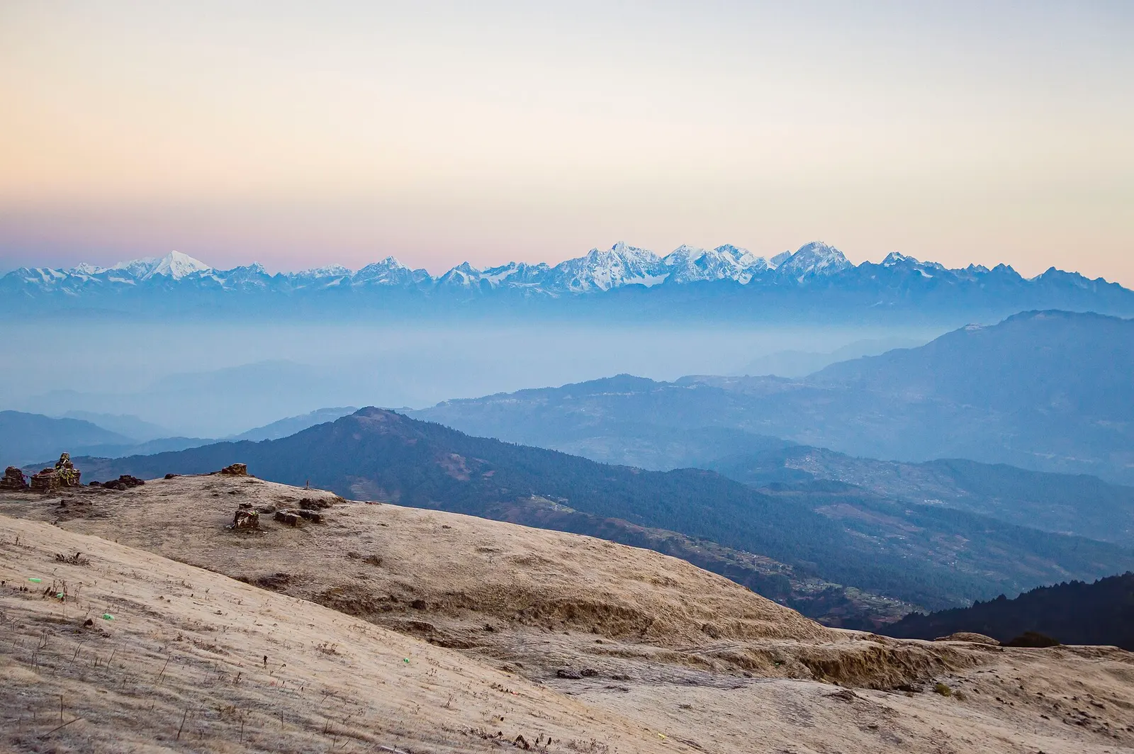
Sailung is a treeless ridge of small grass hillocks, the 'hundred hills', at 3,146 m on the border of Dolakha and Ramechhap, with a view tower and a chorten on its highest point. From the top a long line of Himalayan peaks, Gaurishankar among them, fills the northern horizon, and people pitch tents on the open grass for the sunrise and, in winter, the snow. The road from Mude on the Charikot highway ends at Kalapani, where the rural municipality sells a Rs 50 entry ticket; from there a stone stairway and a trail reach the top in about 1 to 1.5 hours. A second road ends at Khola Kharka on the Ramechhap side, and both villages have a few lodges.
Getting there
No vehicle access · 75 min walk
DirectionsNo vehicle access · 75 min walk
How to get there
- Kalapani (Sailung Rural Municipality, Dolakha), where the northern road ends
- Four-storey view tower and a Bodhi chaitya (chorten) on the highest hillock; the stone stairway called the 'Mini Great Wall' above Kalapani; Sailungeshwar Mahadev temple and cave; the Bhimsen sword rock.
- Mude-Baghkhor-Dhunge-Kalapani road, which leaves the Lamosanghu-Jiri (Charikot) road at Mude; about 19 km from Mude to Kalapani.
- Kalapani parking area and ticket counter, at the foot of the Mini Great Wall stairway. A second trail starts at Khola Kharka on the Ramechhap side.
- Available · Signposted parking area at Kalapani beside the start of the stairway; it fills up on holidays such as Nepali New Year.
- Kalapani on the Dolakha side (buses and private vehicles reach its parking area) or Khola Kharka on the Ramechhap side.
- Blacktop from Kathmandu to Mude. Of the 19 km from Mude to Kalapani about 9 km were blacktopped by November 2025; the rest is a narrow, bumpy dirt road under upgrade. It turns slippery and vehicles can get stuck after snow and in the monsoon.
- A direct bus runs from Kathmandu (Jadibuti / Koteshwor) to Kalapani, leaving about 7 am and taking around 6 hours; it returns from Kalapani about 8-9 am. Otherwise take any Charikot or Jiri bus to Mude and a local bus or jeep on to Kalapani. By motorbike or car it is a one-day drive from Kathmandu.
- From Kalapani climb the stone stairway (the 'Mini Great Wall', about 450 m long) and follow the trail over the grass hillocks to the view tower: 1 to 1.5 hours, steep in places, and hard to follow in fog. Khola Kharka on the Ramechhap side is closer to the top.
- 4.5 km (reported by a visitor)
- 75 min (reported by a visitor)
- Moderate
Facilities and ground
- Grass
- No shade
- Exposed
- No shops on the hill. Tea shops and small lodges at Kalapani and Khola Kharka; the last proper bazaar is Mude, 19 km before Kalapani.
- Lodges at Kalapani and hotels and homestays at Khola Kharka serve meals; yak (chauri) milk, churpi and local potatoes are the specialities.
- Kalapani: 2 to 3 lodges and a round guest house, often full in peak season. Khola Kharka: hotels, a community lodge and homestays in about 10 houses. More lodges at Dhunge and Mude.
Fees and permissions
- NPR 50
- Per person
- Required
- Rs 50 per person entry ticket at Kalapani (Rs 25 for students, children and senior citizens; local residents free), charged by Sailung Rural Municipality from the fiscal year that began in July 2025 and continued from 17 July 2026. No national park or conservation area permit applies.
- The dirt section from Mude is muddy and difficult; cloud and fog often hide the view and the trail.
- Snow falls on the hillocks between Poush and Phagun; the dirt road gets slippery and vehicles and motorbikes can get stuck. Nights are well below freezing.
15 things nobody has reported yet
Community
Condition reports
Photos · 4
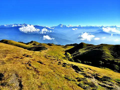
The grassy hills of Sailung with the Himalaya behind. Photo: Ujwal thokar / Wikimedia Commons, CC BY-SA 3.0
Deleted user · 9 Oct 2011
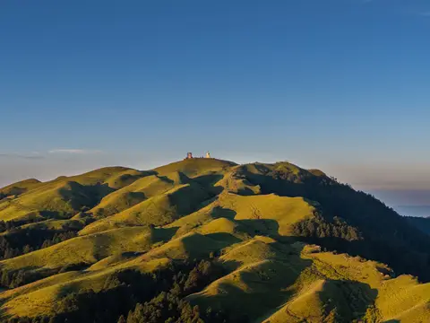
Morning light over the Sailung hills. Photo: Megaurab09 / Wikimedia Commons, CC BY-SA 4.0
Deleted user · 10 Sept 2024
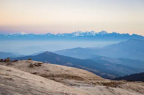
Jugal Himal and Langtang Lirung seen from Sailung Danda. Photo: Subarna1228 / Wikimedia Commons, CC BY-SA 4.0
Deleted user · 11 Nov 2017
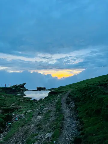
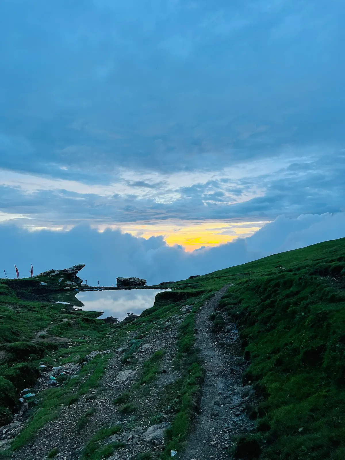
Trail and pond on the Sailung ridge in the monsoon. Photo: Utsab-paude99 / Wikimedia Commons, CC BY 4.0
Deleted user · 16 Jul 2023
Community reports are personal observations on a given date. They are not verified by campinnepal and are not safety advice. Check locally before you go.
Be the first to share something about this campsite
Gear rental nearby
See all vendorsNo vendors listed within 40 km.