
Bethanchok Narayansthan
बेथानचोक नारायणस्थान
Unavailable
No vehicle access
About this place
Bethanchok Narayansthan is in Kavrepalanchok, Bagmati Province, Nepal, at 2,924 m elevation (OpenStreetMap). Last dated first-hand observation: 21 Dec 2024 (more than a year ago).
Bethanchok Narayansthan is the top of the Mahabharat ridge in Bethanchok Rural Municipality, Kavrepalanchok, with a small Narayan temple and a bare concrete shelter on the summit. The Himalaya line the northern horizon and the Tarai plains lie to the south, and people camp here for the sunset and sunrise. Buses run from Kathmandu through Panauti to Dhunkharka, from where the climb takes 3 to 5 hours; motorbikes and jeeps can take a dirt road to within about an hour and a half of the top. There is no water or shop on the hill, so campers carry everything up and their rubbish back down.
Getting there
No vehicle access · 240 min walk
DirectionsNo vehicle access · 240 min walk
How to get there
- Dhunkharka (Dhungkharka) bazaar, Bethanchok Rural Municipality. No settlement on the hill itself.
- Small Narayan (Vishnu) temple and a Shiva shrine on the summit; one bare concrete shed and a few tin sheds beside them.
- Panauti-Khopasi-Dhunkharka road; a dirt road climbs on from Geldung (Dhunkharka) towards the summit.
- Dhunkharka bus park (the trail and motor track cross the Patne Khola bridge), or the end of the dirt road above Geldung where the stone staircase starts.
- Available · Unattended open space at the end of the dirt road above Dhunkharka; vehicles are left at the owner's risk. Bring a good lock.
- Buses stop at Dhunkharka. Motorbikes and four-wheel-drives continue on the dirt road to a parking spot at the foot of the staircase, about 1 to 1.5 hours' walk below the summit.
- Blacktop from Kathmandu through Banepa and Panauti to Khopasi, then partly gravel and rough to Dhunkharka; above Dhunkharka a steep, bumpy dirt track. The floods of 27-28 September 2024 washed out parts of the Panauti-Dhunkharka road; buses were running again by 2026.
- Bus from Kathmandu (Ratna Park or Koteshwor) to Panauti, about 1 to 2 hours; change to the local bus Panauti-Dhunkharka, about 45 minutes to 1 hour 45 minutes. A direct Kathmandu-Dhunkharka bus also runs. Buses to Dhunkharka are few, so start early.
- From Dhunkharka a climb of roughly 1,000 m: 3 to 5 hours on the motor track and forest trail (6 hours with heavy loads in the monsoon). From the dirt-road end, a stone staircase via Thulachaur and Ghodabandhe takes 1 to 1.5 hours. Other routes come from Kamidanda (about 4 hours) and from Sola Bhanjyang via Nangedanda (about 2 hours). The last stretch is steep.
- 240 min (reported by a visitor)
- Moderate
Facilities and ground
- Available
- None
- No bins or collection at the summit; carry all rubbish back down.
- No written rule found. The summit is ringed by community forest: a forest fire in January 2025 burned about 100 hectares here and visitors were asked to stay away for a week. Campers report lighting fires with dead wood; take great care in the dry season.
- None on the hill. Shops in Dhunkharka bazaar, where the walk starts.
- Hotels and eateries in Dhunkharka bazaar and along the road a few kilometres above the bus park; nothing at the top.
- Homestays and small hotels in Dhunkharka, including Bethanchowk Village Community Homestay and Mount Mahabharat Homestay & Retreat (45 to 60 minutes' walk above the bus park, 1.5 to 2 hours below the summit), which also arranges tents and guided camping.
Fees and permissions
- Not required
- Community forests of Bethanchok and Khanikhola rural municipalities (including Bethanchok Narayansthan and Narayansthan community forests). Not a national park.
- Fog, rain, leeches and a slippery trail; landslides cross the old forest trail and the Panauti-Dhunkharka road can be cut (it was in late September 2024).
- Snow can fall on the summit between Mangsir and Phagun; nights go well below freezing.
17 things nobody has reported yet
Community
Condition reports
Photos · 3
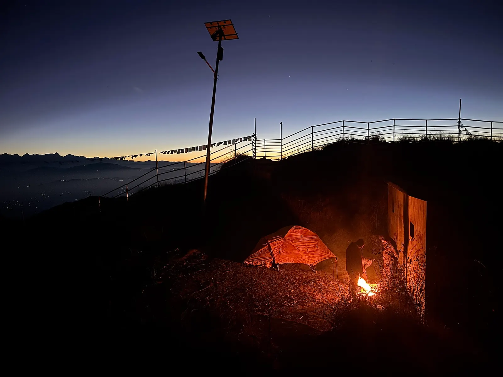
A tent beside the hilltop at Bethanchok Narayansthan before dawn. Photo: Shreemanandhar / Wikimedia Commons, CC0
Deleted user · 21 Dec 2024
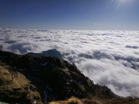
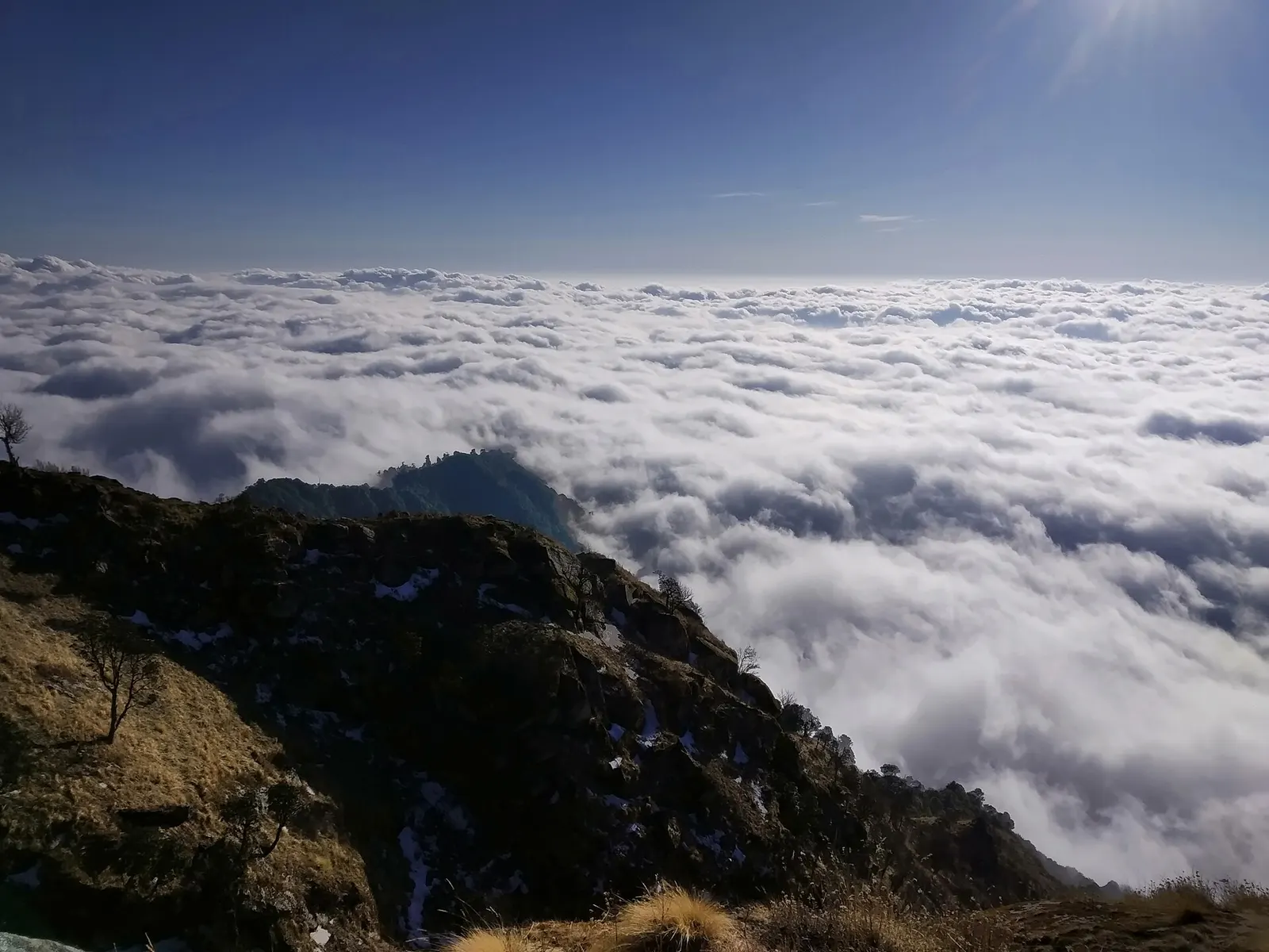
Sea of cloud below Bethanchok. Photo: Rkhadka75 / Wikimedia Commons, CC BY-SA 4.0
Deleted user · 9 Mar 2020
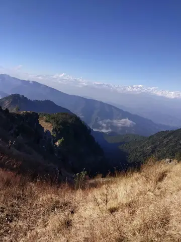
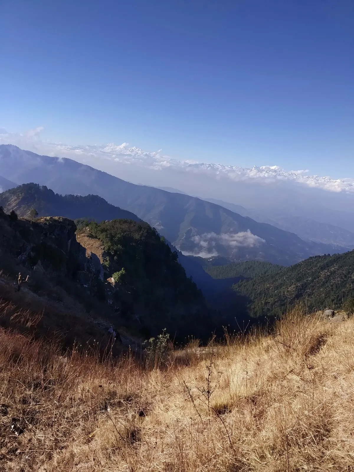
View from the Bethanchok ridge. Photo: Rkhadka75 / Wikimedia Commons, CC BY-SA 4.0
Deleted user · 9 Mar 2020
Community reports are personal observations on a given date. They are not verified by campinnepal and are not safety advice. Check locally before you go.
Be the first to share something about this campsite
Gear rental nearby
See all vendors- Rent My TentContact verified
Lalitpur, Lalitpur,municipality word no.27 · 30.3 km (straight-line)
Pickup hours: Pickup Hours: 24 Hours (24/7) Example: Sunday–Saturday: 9:00 AM – 9:00 AM (next day)