

Thulakot Hill
ठूलाकोट
Motorbike only
Available
About this place
Thulakot Hill is in Kaski, Gandaki Province, Nepal, at 1,410 m elevation (other source). Last dated first-hand observation: 23 Mar 2025 (more than a year ago).
Thulakot is a ridge-top viewpoint in Pokhara-28, above Kalikasthan, at about 1,400 m, with a view tower and an old hill-fort temple. From the top you look onto the Annapurna range and Machhapuchhre and down to Begnas and other lakes of the valley. Local campers ride or walk up and pitch their own tents on the ridge; nobody runs the place as a campsite. Buses go as far as Kalikasthan, from where it is about an hour on foot; a rough road lets motorbikes and 4WDs get close.
Getting there
Motorbike only
DirectionsMotorbike only
How to get there
- Kalikasthan, about 1.2 km west
- Thulakot view tower (white round tower on a paved platform); Kal Bhairav temple in the old kot compound about 300 m west along the ridge; an old tree signposted as five centuries old
- District road 40DR022 (Rakhi-Mijure road) through Kalikasthan; a dirt road follows the Thulakot ridge past the viewpoint
- Kalikasthan bazaar, for those who walk up
- Motorbikes and 4WDs get onto the ridge close to the viewpoint; buses stop at Kalikasthan
- The last stretch to the ridge and the route via Kahun Khola are off-road; a 4WD or a capable motorbike is recommended
- Local buses run from Pokhara to Kalikasthan; by motorbike or taxi about 40 minutes to 1 hour from Pokhara
- About 1 hour (roughly 2 km) uphill from Kalikasthan bazaar, or 10-20 minutes from where the ridge road ends for vehicles
Facilities and ground
- The ridge is reached by a rough road; without an off-road vehicle expect an uphill walk of about an hour from Kalikasthan
- Grocery shops in Kalikasthan bazaar, about 1.2 km west
- Teashops beside the viewpoint sell tea, snacks and simple breakfasts; eateries in Kalikasthan bazaar
- Guest houses in Kalikasthan (Kalika Guest House; New Kalika Restaurant and Guest House); a resort a short walk from the viewpoint
- Kalika Health Post (government) and a pharmacy in Kalikasthan, about 1.2 km west
Fees and permissions
- On the edge of the Lake Cluster of Pokhara Valley Ramsar site (an international wetland listing); not in a national park or the Annapurna Conservation Area
21 things nobody has reported yet
Community
Condition reports
Photos · 3
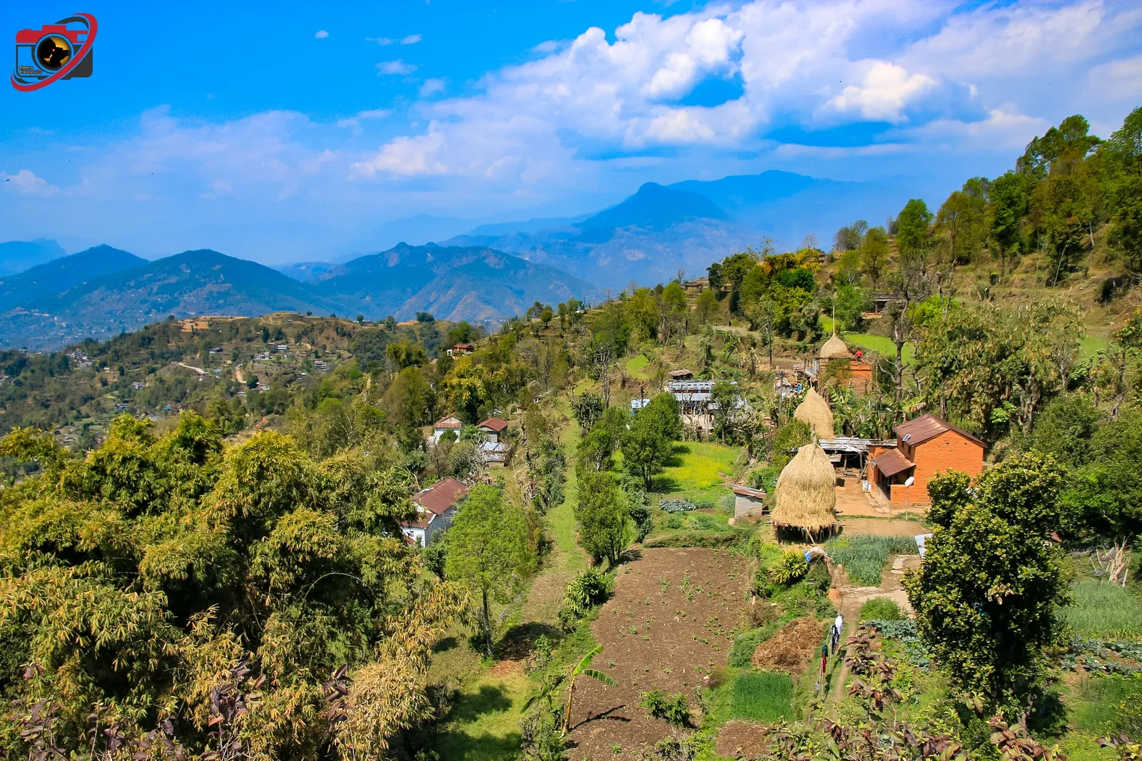
Thulakot village on the hillside. Photo: Rms2039 / Wikimedia Commons, CC BY-SA 4.0
Deleted user · 19 Mar 2019
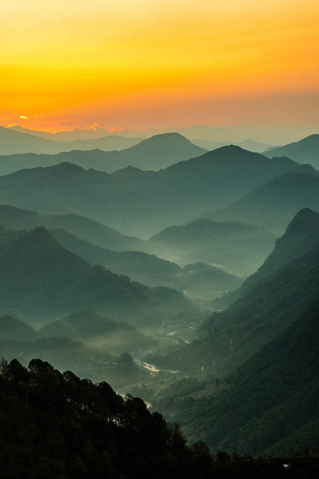
Sunrise view from Thulakot hill. Photo: Chillionaire rohit / Wikimedia Commons, CC BY-SA 4.0
Deleted user · 23 Mar 2025

The old tree at Thulakot. Photo: Chillionaire rohit / Wikimedia Commons, CC BY-SA 4.0
Deleted user · 23 Mar 2025
Community reports are personal observations on a given date. They are not verified by campinnepal and are not safety advice. Check locally before you go.
Be the first to share something about this campsite
Gear rental nearby
See all vendorsNo vendors listed within 40 km.